
History of Graaff-Reinet
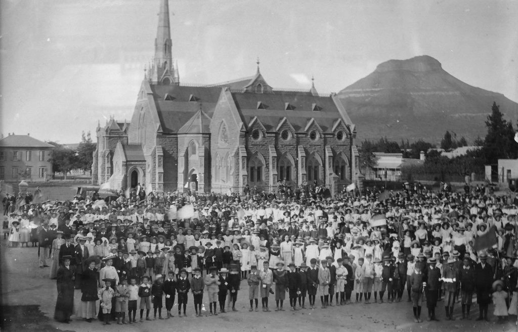
Graaff-Reinet is the oldest town in the Eastern Cape and the fourth oldest town in South Africa after Cape Town, Stellenbosch and Swellendam.
The first European inhabitants of the area were the Dutch trekboere (nomadic farmers) who moved away from the restrictive rule of the Dutch East India Company at Cape Town in search of suitable grazing for their cattle and sheep. The first official farms were awarded in 1770.
The town was founded in 1786 by the Dutch East India Company (VOC) as a trading post and military outpost and was named after Cornelis Jacob van de Graaff, the then-governor of the Cape Colony, and his wife Cornelia Reinet. The town was originally called “de Wiljdgelegen Colonie van Graaff-Reinet”, which means “the Wildly Located Colony of Graaff-Reinet”. The location for the Drostdy and administrative centre was carefully selected as the Sundays River formed a natural protective loop around the settlement, while the fertile surrounding land supported farming and livestock production. The town quickly became an important centre for trade, administration and agriculture in the eastern reaches of the colony.
In 1795, the town’s burghers, who were annoyed with the policies of the remote central government in Cape Town and proclaimed themselves to be the independent “Colony of Graaff-Reinet”. Their independence was short-lived and they were reincorporated into the Cape Colony after the conquest by the British late that year.
The new village of Graaff-Reinet developed slowly and was nonetheless pivotal to the development of the surrounding area. Skilled artisans such as wagonwrights, saddlers, blacksmiths, carpenters and builders swelled the population, and by the mid-nineteenth century, the town was the most important settlement on the eastern fringes of the Cape Colony north of Port Elizabeth. The town was also a major stopover for travellers on their way to the interior of South Africa.
Graaff-Reinet played an important role in the Great Trek of 1835-1842. Many of the families living around Graaff-Reinet became dissatisfied with British colonial rule following Britain’s occupation of the Cape. The town subsequently became one of the major centres from which Voortrekker families departed during the Great Trek of the 1830s. Several notable Voortrekker leaders, including Andries Pretorius, had strong connections to the district.
The town was also a major supply depot for the Voortrekkers who left the Cape Colony to establish their own independent republics in the interior of South Africa. Many of the Voortrekkers passed through Graaff-Reinet on their way to Natal and the Transvaal.
Graaff Reinet became the centre of British military operations for the Eastern Cape during the Second Boer War. During the guerrilla phase of the Anglo-Boer War, raiders from the Transvaal and Free State operated widely in the rugged terrain of the area and was supported by much of the Afrikaans populace. Many, although subjects of the Queen, took up arms and joined the Boers. They were known as “Cape Rebels”. In 1901, several captured Boer rebels were tried in the town for crimes ranging from high treason, murder, attempted murder, arson and robbery. Nine were sentenced to death, with eight of these being executed by firing squad on the outskirts of the town, while the ninth sentence was carried out in Colesberg.
Graaff-Reinet continued to grow and prosper in the 20th century. The town became a major centre for wool and mohair production and it also developed a strong manufacturing sector. Today, Graaff-Reinet is a thriving agricultural and industrial town.
Between 1965 and 1981 Dr Anton Rupert contributed significantly to the culture and heritage of Graaff-Reinet by actively supporting the restoration of many of the town’s most significant and important homesteads and buildings. His enormous contribution to the town has resulted in the development of Graaff-Reinet as one of South Africa’s most significant cultural and heritage centres with more than 220 listed national monuments.
Follow Us
Follow us on our Karoo adventures.
Subscribe
